Severe Weather Update – May 16, 2025
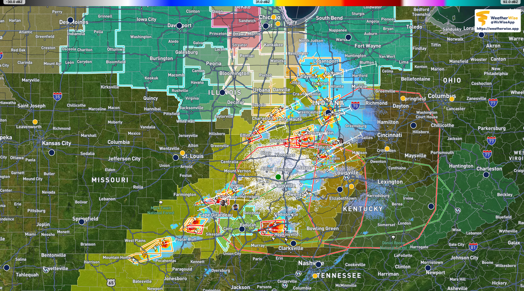
These western Ohio River Valley storms are still fierce & running on rocket fuel, after a tornado straight up struck the core of St Louis.
– storm w/ likely tornado approaching Carbondale, IL & vicinity
– storm w/ likely tornado approaching the I-169 Corridor; Madisonville & Hopkinsville, KY & vicinity
– storm w/ likely tornado along & N of IN SR-54 moving towards the city of Bloomington & vicinity
but there’s plenty more. all of these storms, when they do form (they’re isolated, not linear) are becoming strong to severe quickly. if you see a storm approaching from your west in this region… assume it’s severe or even tornadic, & shelter appropriately before it impacts.
remember – tornadoes can be rain-wrapped & hardly (ot not even at all) visible. looking for the funnel when lots of rain is about is a hazard!
#wxtwitter #kywx #mowx #ilwx #arwx #inwx #ohwx #weatherupdate #tornadowarning
⛈🌀🌥


Comments on 'Severe Weather Update – May 16, 2025' (0)
Comments Feed